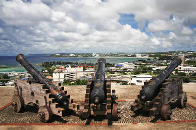
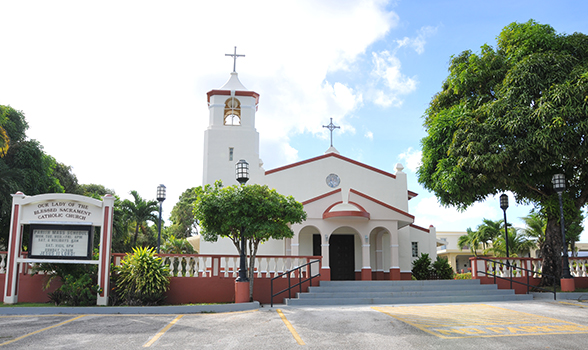
Sites of Agana Heights
- Archbishop's residence
- Elks Club
- Our Lady of The Blessed Sacrament
- The cliff
- Tutujan Park
- U.S Naval Hospital
- St.Fidelis Friary
- Government's House
- Fonte River
Geography
Agana Heights Geographical coordinatesLatitude:
13.464, Longitude: 144.745
13° 27′ 50″ North, 144° 44′ 42″ East
Agana Heights Area
243 hectares
2.43 km² (0.94 sq mi)
13.464, Longitude: 144.745
13° 27′ 50″ North, 144° 44′ 42″ East
Agana Heights Area
243 hectares
2.43 km² (0.94 sq mi)
Bays and Rivers
Fonte River
